
Browse Items (29 total)
Sort by:
Photos of W. King St., Decatur, IL.
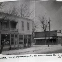
Photograph of Businesses located on the 500 Block of W. King St.
Photos of South Jasper Street during the 1940's and 1950's
Photographs of South Jasper Street and East Eldorado. Photographs of South Jasper Street and East Wood Street. Photograph of South Jasper Street, aerial view.
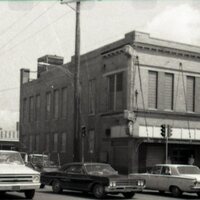
Photos of South Franklin Street
Photograph of businesses along South Franklin Street. Photographs aerial views of South Franklin Street.
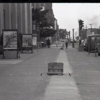
Photos of N. Jasper Street, Decatur, IL.

Photograph of N. Jasper St. business and houses. Photographs of railroad crossing on N. Jasper St. Photograph of men working, street paving on N. Jasper St.
Wabash Railway from the Roundhouse to James St. (No Date)

This map shows the Wabash Railroad from the Wabash roundhouse to E. James St. It shows the entire Wabash yards.
Wabash Railway Station Map: Lands, Tracks, and Structures - Fairview Ave. to College St. (6/30/1938)

This station map shows the lands, tracks, and structures of the Wabash Railway between Fairview Ave. and College St.
Illinois Central Railroad Station Plat Map- Greenwood Cemetery to Wood St. (1953)

This is a station plat map of the Illinois Central Railroad tracks from Greenwood Cemetery to Wood St.
Wabash Railway Station Map: Lands, Tracks and Structures - Monroe St. to Wabash Yards (6/30/194?)
This station map shows the Wabash Railway tracks from Monroe St. to the Wabash yards.
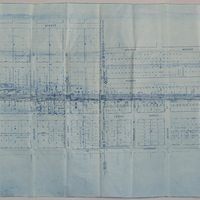
Illinois Central Railroad Station Plat Map - Decatur St. to Cerro Gordo St. (9/11/195?, revised 11/30/1955)

This map shows the Illinois Central Railroad tracks from Decatur St. to Cerro Gordo St. The map shows the industries, additions, and streets between Decatur St. and Cerro Gordo St.